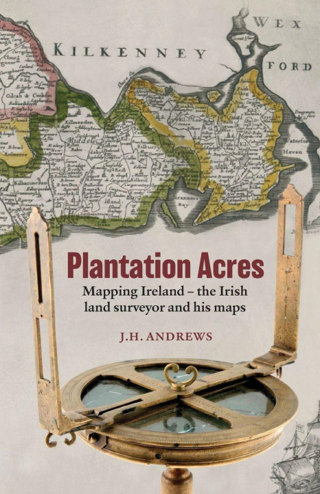
This book deals with an important but neglected element in modern Irish history. Professional land surveyors first appear in Ireland during the Elizabethan period as alien intruders into a system of land reckoning that was still largely medieval, and until the end of the seventeenth century their main role was to measure and map the lands that were confiscated by the government for redistribution to British settlers. Later they were chiefly employed in the survey of private estates, but they also contributed to Ireland's Georgian age of improvement by mapping intended streets and buildings and by laying out roads, canals and drainage schemes, as well as by demarcating many of the proprietorial and tenurial boundaries required by a growing population of farmers. While the most extensive surveys of this era came from a small number of wealthy firms based in Dublin, there were also hundreds of country and small-town practitioners, many of them doubling as farmers, school teachers or tradesmen, whose maps seldom depict more than a single townland.
Shifting in allegiance as they did between the landlord class and the tenantry, Irish surveyors were never universally popular with the general public, and among themselves they were often divided by bitter disagreement on questions of technical competence or professional morality. Much of our knowledge of eighteenth-century surveying methods is derived from these controversies.
Apart from local surveys for private clients, many of Ireland's earliest published county maps and town plans were made by the surveyors who figure in this book. But with the growing competition from the new profession of civil engineers, the nineteenth-century land surveyor was increasingly forced to concentrate on the mapping of farms and small estates, and eventually even this more modest branch of cartography was relinquished to the government's new Ordnance Survey department.
The Irish land surveyor's most enduring legacy survives in the map collections of Ireland's major public libraries and record offices, and these have provided much of the material for a book which is intended to interest historians, geographers, and all those concerned with the changing character of both rural and urban landscapes. First published in 1985 and long out of print, this new edition combines the original text with new prefatory material and a revised and much expanded index.